
You do not need to walk the entire Kumano Kodo network to experience its charm.
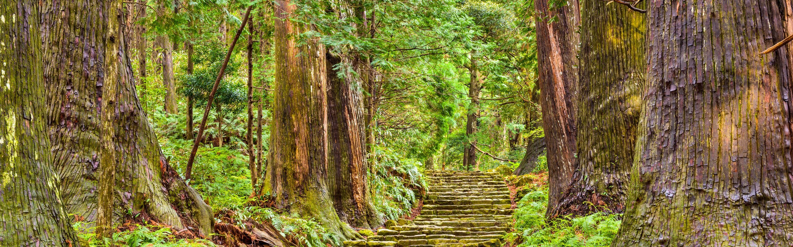
In our experience, 2–3 days are enough to explore the highlights of the trail, allowing you to enjoy cedar forests, ancient stone paths, sacred shrines, historic trail sites, and coastal views in one trip without feeling rushed.
Where Is Kumano Kodo in Japan?
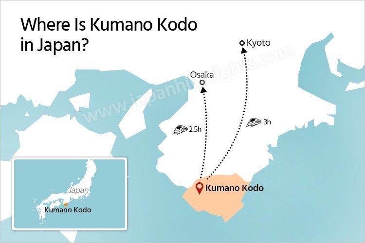
Kumano Kodo is located south of Osaka and Kyoto, on the Kii Peninsula.
It takes about 2.5–3 hours to reach the area from Osaka or Kyoto. Osaka is the closer and more convenient base for exploring the trail.
Kumano Kodo Map: The Best Hiking Routes to Choose
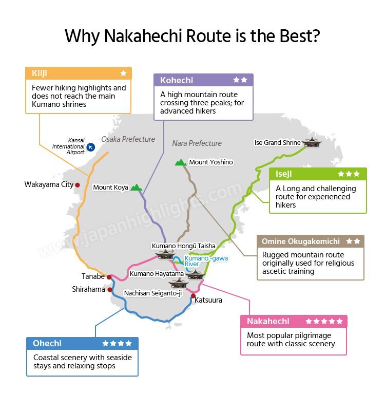
You might assume the Kumano Kodo is a single trail. In reality, it is a network of six pilgrimage routes leading to the three sacred Kumano shrines.
For most first time visitors, the Nakahechi Route is the best one. It has the Kumano Kodo's most iconic forest scenery, the best choice of accommodations, and the shortest qualifying section for collecting pilgrimage stamps and earning the Dual Pilgrim Credential.
Nakahechi Route Hiking Map
The Nakahechi Route is the most popular for visitors. It stretches for more than 100 km, but you don't need to hike the entire trail.
We've selected some of the most scenic sections, as shown on the map below. If you have 2–3 days, choose a part of these sections based on your available time and fitness level. The map helps you decide which parts to include.
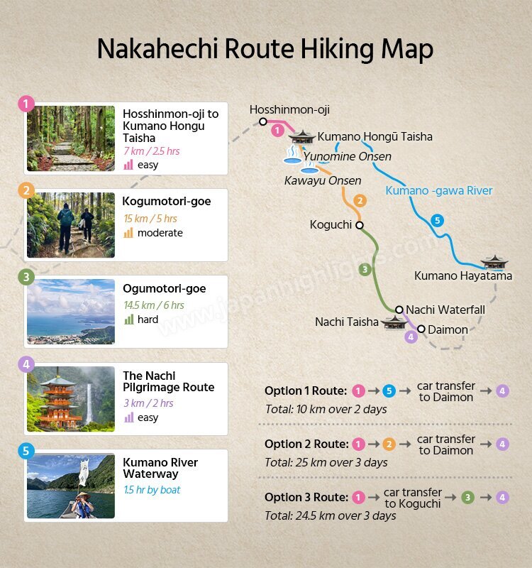
- Hosshinmon-oji → Kumano Hongu Taisha (7 km / 2.5 hrs): Easiest, Cedar Forests, Stone Paths, First Time Friendly
- Kogumotori-goe (15 km / 5 hrs): Mountain Trail, Forest Views, Ridge Walks
- Ogumotori-goe (14.5 km / 6 hrs): Challenging, Pacific Ocean Views, Fishing Villages
- Kumano River Waterway (1.5 hr boat): Nobles' Pilgrimage Route, River Cruise
- The Nachi Pilgrimage Route (3 km / 2 hrs)
Daimon-zaka → Kumano Nachi Taisha → Nachi Waterfall: Shrine & Temple, Nachi Waterfall, Traditional Costume
Kumano Kodo Itinerary Map: How Many Days Do You Need?

For most visitors, we recommend spending three days to experience the classic Kumano Kodo highlights at a comfortable pace.
3-day Kumano Kodo Hiking Itinerary
Day 1: Arrive in Shirahama, visit Sandanbeki and Senjojiki, and stay in a seaside onsen hotel.
Day 2: Nakahechi: Hosshinmon-oji → Kumano Hongu Taisha, Kumano River Waterway, and Kumano Hayatama Taisha.
Day 3: Katsuura Fish Market, then Daimon-zaka → Nachi Taisha → Seiganto-ji → Nachi Waterfall.
If you only have one day, the Nachi Pilgrimage Route is the best choice. It is the shortest route with Kumano's most iconic scenery, though the itinerary can feel quite rushed.
Have two days? Combine Hosshinmon-oji → Kumano Hongu Taisha with the Nachi Pilgrimage Route, then visit the Ohechi coastal scenery.
Kumano Kodo Area Map—Where to Stay
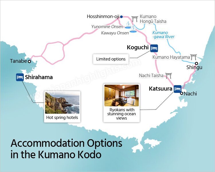
For most travelers, Katsuura and Shirahama are the best accommodation choices because they offer convenient connections before or after your Kumano Kodo hike. You will enjoy a different side of Kumano with dramatic Pacific Ocean scenery, seaside towns, hot springs, and fresh seafood.
Katsuura is the best base if you plan to hike the Nachi Taisha or Nachi area, with easy access to coastal ryokans and hotels.
Shirahama is a convenient stopover when arriving in Tanabe, the closest city to the Kumano Kodo trailhead, or returning to Osaka or Kyoto after your hike.
Osen areas near Hongu Taisha is best for hikers who want direct access to the main Kumano Kodo trails and traditional onsen towns.
It is recommended to book accommodation at least 1.5 months in advance.
Kumano Kodo Transportation Map: How to Get to from Kyoto, Osaka, or Tokyo

Tanabe is the main gateway to Kumano Kodo. From Kyoto or Osaka, take a train to Tanabe, then transfer by bus or car to the trailheads. From Tokyo, the fastest option is flying to Nanki-Shirahama Airport.
If you want to avoid complicated bus schedules and luggage transfers, a private car with a guide is the most comfortable option, especially for families or travelers with limited time.
Let's Help You Arrange Your Hiking Trip in the Kumano Kodo
If you have any questions about planning your Kumano Kodo hiking itinerary or need assistance, feel free to contact us. We'll help you create your Japan itinerary based on your preferences.